One day tours
The island has many hiking trails to the mountains. The highest mountain is 1001m. This means that any route can be completed in a day.
You can choose one of my original car tours, or the classic walking route.
I walked all the trails myself, so I can advise you for your physical and technical preparation. And along the way I’ll tell you stories about the area :)
You can choose one of my original car tours, or the classic walking route.
I walked all the trails myself, so I can advise you for your physical and technical preparation. And along the way I’ll tell you stories about the area :)
Tour along the national hiking trail
Educational tour along the national tourist road. Suitable for everyone, since you don’t have to walk far, everything is accessible, just a few steps away when you get out of the car. Along the way I’ll tell you the history of the places we will pass/visit. We’ll stop near the place where nickel was mined. There is a lot of 'smelted' stone here, and you can even find real pieces of nickel ore. We will visit the area where local reindeer herders - the Sami - used to live, and there was an old pier for ships. Now there are summer holiday homes here. We’ll stop near the observation deck. This is a platform jutting out over the slope overlooking the Bergsfjord, surrounded by mountains. The most beautiful beach on the island is Bøvær beach. We will visit the famous 'Dragon's Teeth (Devil)', and then the most popular beach. Next is the town of Mefjord. If desired and weather conditions permit, we will have a picnic or stop at a cafe before heading home.
We’ll go to the southern part of the island. These are two roads that are very different from each other. The first is between the mountains, where trees do not grow, there are many streams and lakes. The second is the opposite. With trees, lots of greenery, farms. Let's start with a visit to the open-air museum. This is the last residential settlement in which the Sami lived. I'll tell you how they lived here, what they did. Then we will drive along the Kaperdalen road between the mountains, go down the serpentine road to the village where the oldest wooden boat in Scandinavia was found. There was a large settlement here in the Iron Age. We’ll return to the main road and turn onto the second road full of greenery. If you wish, we can stop by the Ånderdalen National Park, take a walk and drive further to the last town of Skrolsvik. We’ll see a very well preserved fort. We can figure it out and go on the day when the halibut museum is open. After this trip you will see how different the island is and understand why it is called Norway in miniature
Tour of the southern part of the island
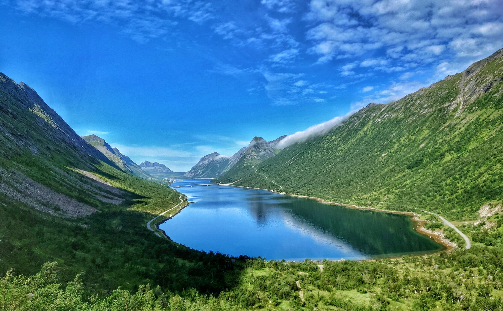
Catalog of routes around the island of Senja
Tour are divided into three categories:
Very easy, without going uphill
More difficult, part of the trail is flat and another part with a bit of climbing
Difficult, with climbing for those who are prepared and not afraid of heights
Very easy, without going uphill
More difficult, part of the trail is flat and another part with a bit of climbing
Difficult, with climbing for those who are prepared and not afraid of heights
Height 639 m
The journey to Mount Segla by car takes about one and a half hours, with stops for photography on the way, it takes longer.
Segla is the most popular mountain in Senja. There are always many tourists here.
The route takes 3-4 hours. It is quite short, about 4 km, but the last 800 meters climb steeply. Markers on the path sometimes disappear and you have to choose where to go yourself.
At the summit, more than 600 meters above sea level, the view of the mountain peaks in the distance is breathtaking.
I recommend the Hesten tour to see Segla in all his side-on glory.
Height 555 m
The journey to the Hesten tour takes an hour and a half by car, with photo stops along the way taking longer. The ascent/descent takes about 2-3 hours.
The tour is designed to see Mount Segla from the other side. The climb is quite steep, but not difficult, so it is suitable for most people. As you climb, you will see how the mountain changes from wide, powerful to narrow, but does not lose its majesty. Several tracks lead to the cliff, so together we will choose the most optimal route for you.
To see the famous view of Segla mountain, it is enough to choose the shortest path to the cliff.
Height 807 m
The route lasts 4-5 hours
This is the first peak of the mountain range that separates the Kaperdalen and Svandalen valleys. The climb is not steep, the mountain path has an open view. Only closer to the top the path passes through the stones.
Here, in March 1966, an American plane flying to Bardufoss crashed due to poor visibility. The remains of the plane remain on the mountain; you can read the history on the stands.
One of the smallest national parks in Norway. In the park you can see 600-year-old pines, 200 species of vascular and dwarf plants, orchids, and about 90 species of birds.
Ånderdalen Park was an important place for people already in the Stone Age. There are many historical places registered here.
The path through the park is flat, without climbs, suitable for everyone. There are 2 routes in the park:
walk 3 km to a beautiful view with a house, have a snack and move on. Or walk to the lake: 3 km along the path, and another 3 through swamps and fields.
Height 215 m
One of the short tours for 1-2 hours, 1.2 km long. You will see a very beautiful view of the town of Torsken and the fjords. From here you can continue on to Mount Midtertinden.
One of the short tours for 1-2 hours, 1.2 km long. You will see a very beautiful view of the town of Torsken and the fjords. From here you can continue on to Mount Midtertinden.
Height 623 m
The summit of Midtertinden is visible from the window of Senja Camp. And the beginning of the route is a few minutes by car.
The tour starts in the town of Torsken and takes 3-4 hours. We will first follow the Ravnfløy route, stop at the Ravnfløy platform and continue through the forest along a rocky path. Then a steep climb up, and, having passed through the valley, we will find ourselves at the top. From here we will see the villages of Torsken and Gryllefjord.
And on the mountain, a Norwegian artist laid out a face on a stone. We need to find him.
Ånderdalen nasjonalpark
Height 380 m
The tour starts in our village and takes 2-3 hours. Very good for those who are tired from the road and want to spend the day on the move.' At first the climb is quite steep, but then the path reaches a plateau where you can walk calmly and safely.
It offers stunning views of the open sea. This is the place where two fjords connect.
From here you can continue to the top of Middagstinden. Now, the hardest path is already behind us. There is a good, safe path to the top.
Height 542 m
On average, this tour takes 3-4 hours. The first part of the tour, which is also the hardest, goes along the Glæret route. We’ll climb further from the plateau and we will see a view of Gryllefjord and the peaks of the neighboring mountains.
In Gryllefjord quite often the fog rolls over the mountains like a waterfall. We will try to catch this mesmerizing view, because being above the skies is an unforgettable experience.
Height 456 m
2-3 hours
The start of the journey is only 15 minutes by car. This is a very beautiful and not difficult tour through the forest to the lake. On the lake we will see a dam built in 1882. Here was the first hydroelectric power station in Europe.
Further on the path is sandy and slightly steeper. Many people stay to admire the beauty here. From here you can see 90 islands in turquoise water.
You can climb even higher to a large stone, which is called a witch (when you look at it from the lake, the stone looks like a witch). The bravest go to the top, but the last few meters are not for everyone. Climbing and descending through a chain, on slippery stones.
Glæret
Middagstinden
Height 975 m
From the village to the start it takes half an hour by car. The walking part will take 3-4 hours.
The second highest peak on the island. A tour for those who are prepared and not afraid of heights. It looks simple, but the last part of the trail to the top is very steep, the path is sandy, and rocks are falling down. In places you need to think carefully - where to grab, how to rise. Of course the view is worth it! The whole island is in sight..
Height 635 m
Before the start of the walking route, it is an hour by car, the walk will take about 3-4 hours.
This peak is on the list of the most visited on the island. This tour is also called 'Royal' because it is one of the favorite tours of the Norwegian Queen Sonja.
Not hard, smooth climb. Some people stop in the middle of the road - Sommardalen (height 327), but it’s no more difficult to climb further, so just go ahead! At the top you will be greeted by the sea and the horizon, views of the most popular "dragon's teeth" rocks and sandy beaches.
Stormoa
Height 611 m
20 minutes drive from the village.
A relaxing tour along a forested, open mountain trail. Takes 2-3 hours. Very smooth climb. Therefore, it is suitable for all lovers of walking. At the top there is a view of the islands, the peaks of neighboring mountains, and the fjord.
20 minutes drive from the village.
A relaxing tour along a forested, open mountain trail. Takes 2-3 hours. Very smooth climb. Therefore, it is suitable for all lovers of walking. At the top there is a view of the islands, the peaks of neighboring mountains, and the fjord.
Husfjellet
Flobjørn
Before the start of the walking route - half an hour by car, the walk will take about 3-4 hours
A beautiful, effortless tour. The path goes all the time along the edge of the fjord, through the deserted settlements of Lavoll and Smevik. We’ll get to the German fort founded in 1942. The fort was quite large, about 300 soldiers lived in it...
A beautiful, effortless tour. The path goes all the time along the edge of the fjord, through the deserted settlements of Lavoll and Smevik. We’ll get to the German fort founded in 1942. The fort was quite large, about 300 soldiers lived in it...
This tour is only 1 km long and takes 15 minutes to get to the start. The path goes smoothly to a low peak, from which small islands and the other side of the fjord can be seen. This is a very good place to see the sights around: the nickel mine, the dam, the other side of the fjord.
Utsikten
Flatneset
Here you can decide for yourself how far to go.
When you get out of the car you will see the valley and the sea.
We can walk for 10 minutes, rise 300 meters above sea level, and see both sides of the fjord.
Another 20-30 minutes and we will rise to 385 m. Not high, but the trail will lead along the edge of the cliff, and then there will be an ascent. We will go out to the observation deck above the tunnel, we will see: the road, the valley and the sea, the fjord, the bridge, Gryllefjord...
Småtinden
Book a place
Book a place to see the best places in Norway with your own eyes!
One-day tour with a guide on the island of Senja 300 euros per group.
One-day tour with a guide on the island of Senja 300 euros per group.
